At time of writing, I am sat in a hotel just outside Paris, on my way back to the UK. This year's alpine adventure is coming to an end.
Showing posts with label 2013. Show all posts
Showing posts with label 2013. Show all posts
Wednesday, 28 August 2013

Tuesday, 27 August 2013
Something to See: Vallandry
If you are ever in the Vallée du Ponteuran and are in need of a spot of souvenir shopping, Vallandry is the place to go.
Monday, 26 August 2013
Loving it in all weathers - Part 2
At time of writing, I am sat in the kitchen of the chalet just outside the Vanoise National Park. It is 6:45pm, and going outside is currently not a wise idea: the rain, mist, thunder and lightning are encroaching, and stepping only a couple of feet outside of the chalet will make me drenched to the bone.
I have already been saturated today: this current downpour began this afternoon, when I was venturing back up to the National Park at Rosuel. There was mist and rain, and I guess you could call it bleak.
But the landscape looked amazing. Inverted cloud and mist sat beneath needle-like mountain tops, making the latter look even higher and more menacing. White glacier intermingles with grey cloud, and the waterfalls appeared to fall out of the heavens and into the abyss. Absolutely tremendous stuff.
It is funny how the weather can change your views, and in some cases even improve them. Yet another reminder that places are worth exploring in all weathers.
Sunday, 25 August 2013
Col de Grassaz

An epic walk which can be completed in a day
START: Rosuel
FINISH: Rosuel
DISTANCE: 11 miles
TIME: 6 hours
Of all the walks i have done in the Alps this year - maybe even of all the walks I have done in the Alps full stop - there have been none quite like this. This walk feels like Alpine walking more than any other - wild, ever-changing terrain with constantly beautiful, continually surprising views.
Indeed, this is one of the definitive areas of the Vanoise National Park. From the National Park portal of Rosuel there are just so many walks: from small terrace walks and investigatory walks to the tremendous waterfalls to morning walks to the Lac de la Plagne to treks to the various mountain passes, including the Col de la Sachette and Col du Palet, both of which have fantastic views. This col, the Col de Grassaz, is the most spectacular of the bunch.
Beginning at Rosuel, take the main track eastwards, along the south side of the valley towards the valley head. Already the views begin to open up: water tumbles off the opposite cliffs in impressive waterfalls; occasionally you may see the shadows of the Lamaguire, one of the alps' resident species of vulture, stalk those same cliffs. Above the various needles and Aigilles combine to create a picture of constant turbulence yet natural harmony. If there was a definitive alpine view (and there are many competitors on this walk alone) I would probably choose that one.
View this route in a larger map
The path continues, with two forks leading on to the terrace walk above; ignore both and continue along the bottom path. The path winds up first through the valley and then up through the forest. If this were a shorter walk I could spend ages just detailing the intricacies of this section: crossing the largely dried-up river; walking up the switchbacks along the (not severe) cliff edge; and finally entering the beautiful wooded section of the walk with its dappled sunshine and lush green grass. This final section offers some relief: a brief descent in the forest follows the previous continual ascent from the car park.
 |
| The view from Rosuel |
After this brief meadow section, you ascend quite steeply and sharply through a gully, with high hillsides on either side. When you reach the end of the gully, you leave the relatively narrow valley and its tumbling waterfalls behind, and the hills around you open up in front of you. The hillsides of Mont Pouree are up to your left, and those of the great pyramid l'Allait to your right. In front of you, meanwhile, the alpine pasture mingles with a boulder field and a series of small streams; it is as if you had passed through a portal into another world. Continue along the path as it snakes round to the left, passing a hidden gorge down to your left, its cliff faces and pounding river making for an alpine valley in miniature.
Soon you will come to a fork on the road and a signpost. For some reason the Col de Grazza does not make an appearance on any of these signposts for a long time - you will be wanting the left hand path, with the right hand path leading to the Lac de la Plagne. Follow this left hand path through the remainder of the boulder field, and soon you leave it behind for a much nicer path through another alpine meadow.
This meadow is different to others, however. The white tufts of bog cotton (which until now I had not seen outside of the Lake District, let alone outside of the UK) to your right indicate the presence of marsh, so do not drift too far in that direction. However, the path itself is not wet, and the long green grass which makes this section particularly distinctive is nice on the legs to walk on. The views are also becoming teasingly tantalising: just beyond the brow of the hill in front of you the snow covered hump of La Grande Motte rises like the sun at dawn, while the cliff scenery to your right and the glacial views to your left are reaching the peak of their splendour. Continue through this valley meadow and you will pass a series of chalets, which appear to have been abandoned for some time – a shame, given the tremendous location.
After the chalets, the path starts to rise, and it is here the fun really begins. Follow the path round the curve of the hillside, and relatively soon you will come to a small hut. Take a break on the rocks here or continue along the path and you will have a fantastic view down into the valley below you: the gorgeous Lac de la Plagne sits sparkling in the sun, its popularity indicated by the enormous (by refuge standards at least) refuge plonked on its eastern shore. Above them, the buttress of l'Alliet's neighbour (the poorly named Mont Blanc de Peisey, which as far as I can see is not particularly white but a heck of a mountain nonetheless) sits menacingly, as if it is about to let go of the mountainside it clings to and fall onto the lake below. Up to your left, all manner of glacier sit. Perhaps best of all, along this section of the path, the marmots appear very amiable and happy to have their photos taken. For once, it is a case of being very unlucky NOT to see a marmot, rather than lucky to see one.
As you round the final corner of the hillside, the white lump of La Grande Motte once again rises into view. You will notice that one side of the Mott has ski lifts up it, while the other is nothing but unspoilt white snow and jutting black crag, a perfect example of the arbitrariness of this national park's boundaries.
As La Grande Motte once again rises into view, you come into another alpine pasture. And it is here, for the first time, you realise you are now truly in the wilds of the Alps. The refuge and the lake, the bog cotton marsh, the boulder field, the alpine meadow, the forest, the gorge of waterfalls: all of this stands between you and the car park. A lone shepherd's hut on the far side of the valley is the closest you get to such civilisation. Cliffs now guard both sides of the valley, those on your left casting a large shadow over the rest of the valley for much of the morning.
You will not have to go far before you have to make a crucial decision. Above you, in the very wilds of the Vanoise, are three cols. The left fork in the road leads to the Col du Palet, situated straight ahead. The Col de Grassaz, meanwhile, is up to the right. All three cols are worth visiting, but if you can only go to one I suggest the Col de Grassaz: less frequented than the Col de Palet, partly due to it not being on the Grande Randonée 5, it has (as we shall see) absolutely gobsmacking views over the other side. Ergo, take the right-hand path up the steep hillside, towards our destination.
The path moves steeply up the hillside and into the final phase of the walk. After the short, steep ascent you come into a lovely alpine pasture, the variety and colour of the wild flowers very similar to those in the previous meadow, though with the added bonus of no trees to obscure the view. To your left, a river runs into a little lake, with perhaps a herd of cattle patrolling its shore, the bells around their necks joining the sounds of the river in creating a symphony in the mountain air. Above all of this, the jagged needles of the Aigilles Noire sit proudly over their kingdom. Rise up through this pasture, overcoming the undulating drumlin landscape, and you will have just one short, sharp pull up to reach the Col.
And wow! The blackest mountain ridge, so long that it extends beyond the bounds of visibility, behind the hills either side of the Col. High monoliths compete with pointed peaks and huge bulky behemoths clamour for your attention, with the comparatively tame Grande Motte looking on despondently in the very corner of the eye. La Grande Casse, the largest and most central of those rocky juggernauts, pervades throughout. And over this hall of kings, a white blanket is draped: the glacier fills every single nook and cranny of this enormous range: indeed, I have never seen so much glacier all in one place. The Grande Casse's glacier is just like the mountain it clings to, a big slab of ice which could cause terrible destruction if it saw fit. Whether in the middle of a perfect storm or below a brilliant blue, this range of mountains would probably always look frightening and awe-inspiring in equal measure.
 |
| Pictures cannot do it justice. The Grande Casse's range and glacier extend far to the left and the right. |

And then step back. The col itself is extremely safe, a grassy meadow perfect for a picnic and to take pictures of the scenery in front of you. The view behind is not half bad either: icy peaks have begun to appear behind the Col de _______, and the near mountains and Aigilles are also very impressive. But it is that view, the one looking towards the Grande Casse and its neighbours, which always catches the breath.
 |
| The view on the descent from the Col de Grassaz |
Suffice to say, if you can only do one walk in this area, do this one. The variety of terrain, the spectacular views and the tangible sense that, for however few precious hours, you are truly "away from it all" make this walk necessary for any discerning hiker.
Definitive.
Saturday, 24 August 2013
Lac des Moutons

"If that's Mont Blanc I'll eat my hat..."
START: Arc 2000
FINISH: Arc 2000
APPROX DISTANCE: 9km
APPROX TIME: 3 hours
And there it is: Mont Blanc. As we drove up out of the ski village Arc 1950 to its higher counterpart Arc 2000, the Alps' (and indeed Europe's) highest mountain loomed up in front of us. The sheer height accompanied with its sprawling snow-covered massif makes the mountain almost unbelievable, especially as it appeared everything in between myself and the mountain appeared to be rolling hills loved by skiers. This walk is probably best if you do want a great view of Mont Blanc's southern side, as well as some beautiful lakes and pools combined with some spectacular cliff scenery.
Friday, 23 August 2013
Notre Dame des Vernettes

A great walk with a difference
START: Nancroix
FINISH: Nancroix
APPROX DISTANCE: 2 miles
APPROX TIME: 1 hour 45 minutes
Having said what I did in my previous post, there are still some remnants of settlement in this valley, and sometimes they offer great viewpoints as well as brilliant places to visit in and of themselves. This is one such example: a lovely chapel which goes by the name of Notre Dame des Vernettes.
Thursday, 22 August 2013
Introduction to the Vanoise National Park
 |
| The Col de l'Izeran |
The valley I have found myself in, meanwhile, is itself beautiful. The valley of the Ponteuran river is what you could call the last bastion of wilderness in the area: while the wilds of the Vanoise National Park can be found at the head of the valley, travel in the other direction and you will find yourself swamped by ski slopes and other traits of urban life creeping into the countryside.
In the valley itself, the wilderness survives: just from my chalet I can see forests, rolling hillsides, craggy peaks, tremendous waterfalls and wonderful glacier, with hints of lakes in some of the higher corries. The great alpine bird of prey the lamaguire (also known as the bearded vulture) are said to roost in the highest peaks. This is wild territory, and no mistake.
 |
| One of the many waterfalls to be found in this valley |
Over the next six days i will be sharing with you the best this valley has to offer.
Enjoy!
Wednesday, 21 August 2013
The Serre-Ponçon Conclusion

Time to say goodbye to the Serre-Poncon area
At time of writing, I am sitting at the caravan at the lac de Saint Apollinaire campsite on a warm afternoon, having just finished our last walk in the area. Tomorrow we will be heading to the Vanoisse area of the Alps.
That walk was one last ascent to the Aigilles de Chabrières. Being the closest and most walked point in the area, it seemed appropriate to visit one last time before we leave the area.
Fort de Réalon and Cascades de la Pisse

A great walk which incorporates historical and geographical wonders.
START: Réalon
FINISH: Réalon
TIME: 1 hour 45 mins
Up above the small village of Réalon sits a ruined fort. Built in the fourteenth century, you can see why the French military at the time built it - the land it sits on has great views up and down the valley and beyond; what was once a great military outpost is now a fantastic viewpoint.
Tuesday, 20 August 2013
Lac de Crachet

A beautiful hidden gem.
START: La Chalp
FINISH: La Chalp
DISTANCE: 7km
TIME: 2.5 hours
It's funny how everything fits together. If you stand at the carpark just up from the little village of a La Chalp and look south, the hillside which faces you is that of Le Meale, the focus of the walk from a few days ago. Le Meale is not the focus of today's walk, however: that is the picturesque Lac de Crachet.
Le Col de Petite Cayolle
A beautiful walk from start to finish, with a surprise around every turn.
START: Col de la Cayolle
FINISH: Col de la Cayolle
TIME: 3-4 hours
Well I certainly did not expect that!
 |
| Look! It's a chamois! |
We are on our way to the Col de Petite Cayolle, having parked up at the Col de Cayolle, and a chamois (alpine mountain goats which are incredibly rare) hurtles down the hillside towards us. Having probably been disturbed by walkers higher up the path, the chamois charges down the rocky hillside, across a large patch of snow, then crosses the path we are watching it from, and then once on the other side appears to carry on grazing to its heart's content. A truly great - and unexpected - moment.
This is a walk that is full of surprises. The first was probably the drive up to the Col de la Cayolle itself. Approached via the Ubaye valley and the town of Barcellonette, any intrepid explorer is in for a hairy ride through narrow gorges and along cliff edges. Make sure you keep your wits about you as you ascend to the Col.
The Col de la Cayolle is in the heart of the Mercantour National Park, the most southerly of the alpine national parks. Once you reach this first pass by car, you begin to glimpse its beauty: forests and mountains meet in an area which is truly wonderful.
Sunday, 18 August 2013
The busiest and the quietest
This morning, on the way to the town of Chorges, I spotted a word on the road in big red letters: "Froome".
Something to Spot: Barrage de Serre-Ponçon
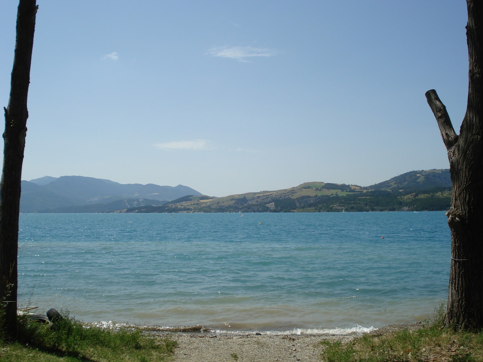
If you are ever travelling on the western side of the lake, be sure to stop off and see the structure which made it so: the Barrage (dam) de Serre-Ponçon. There is a viewpoint for you to see the dam itself, along with information about the dam's formation and even a museum and a couple of gift shops.
The dam itself is not particularly spectacular: although quite large, most of it is underwater and the more impressive southern side is not really visible. However, it is worth a stop off just to appreciate the amount of work and effort that went into building one of the most beautiful lakes in Europe. It is therefore a reminder that helping people does not necessarily mean damaging the landscape. There is also a great view of the lake from the viewpoint.
Definitely give this a look if you are in the area.
Loving it in all weathers

Saturday, 17 August 2013
Pic de Morgon

Second time lucky.
START: le Grand Clot
FINISH: le Grand Clot
DISTANCE: 9km
TIME: 3 hours
Time for some unfinished business. Last year, I attempted to ascend the mighty Pic de Morgon, which, sat bang smack on Lac de Serre Ponçon's shoreline, is the closest this area has got to an iconic mountain. However, due to a mixture of bad weather and poor route choice, I ended up not making the climb onto Morgon's lofty top. Ever since, it has been staring at me from the other side of the lake, its ferocious crags mocking my failure.
However, this year is different. Parking at a different car park, with better weather and a clearer route, I shall now deliver to you the definitive Pic de Morgon walking guide.
Something to Spot: Les Demoiselle Choiffée
 |
| One of the Demoiselle Choiffée |
The Demoiselle Choiffée (literally translated into something like "the ladies with the fancy hair") are like something out of a fantasy novel: enormous boulders sit atop pillars of rock and gravel, like giant stone mushrooms; the product of glaciation, they really are a sight to behold.
The extent of the walk is only a hundred metres from the car park, so a great walk for kids or if you want something more leisurely. It is certainly essential viewing even for experienced walkers who are perhaps on their way to something a little more challenging. Well worth a look.
Friday, 16 August 2013
Le Meale

Hit the heights - no ice axe required!
START: Parking du Meale (near Les Orrs)
FINISH: Parking du Meale (near Les Orrs)
DISTANCE: 5 miles
TIME: 3hours
One of the best parts of remaining outside the Écrins National Park is the possibility of getting on to the tops of mountains fairly easily. While the valleys, lakes and glaciers are wonders to behold, ice and cliff make the high Écrins peaks largely inaccessible without ice axe, climbing gear and a wealth of experience. Outside, however, anybody can bag themselves an alpine top, and with it a great panorama of views too.
Le Méale is one such mountain. Sat almost exactly opposite to Mont Guillaume, with an equally spectacular view of the entirety of the Lac de Serre-Ponçon, Le Méale is a great viewpoint for those who prefer walking without having to lug an ice axe about.
Thursday, 15 August 2013
Is there ever a "right" way?
On my travels in the Alps, I have sometimes deviated from the beaten track in order to find somewhere more undiscovered. There has been many an occasion, however, where I have deviated from aforementioned beaten track and been told by a passing fellow hiker that I am going off the track and I really should stay on it. Almost always well-meaning, I guess they often assume that I am lost, even if I have a map in hand.
Breche de l'Homme
This looks familiar... yet different.

FINISH: Lac de Saint-Apollinaire
DISTANCE: 5 miles/ 8km
APPROX TIME: 3.5 hours
My first hike of 2013 is the return to an old friend: the Aigilles de Chabrières are the rugged craggy peaks which sit above my campsite at Lac de Saint Apollinaire, and i walked up to the viewing table to the immediate east of them on more than one occasion last year. As a result, i will not recite how to get up to the aforementioned viewing table again, but instead redirect you to last year's post as to the route to what is - on a sunny day - a breathtaking view.
Today, however, i went a step further: rather than staying put at the viewing table, i went up and into the Aigilles themselves. The Breche de l'Homme is the solitary pass which cuts the Aigilles in half, and acts as my objective for today.
Wednesday, 14 August 2013
Undiscovered Walks 2013 Intro

You have to go the distance to discover.
Subscribe to:
Posts (Atom)