Showing posts with label loudenvielle. Show all posts

Monday, 8 September 2014

Refuge de la Soula, via Gorges de Clarabide

Some walks are memorable for reasons you would expect: for its fantastic views, for example, or for its being a home to particularly rare wildlife. Others, however, take you by surprise.

DISTANCE: 11km
APPROX TIME: 3 hours
START: Pont du Prat
FINISH: Pont du Prat

This walk to the Refuge de la Soula is one of those walks. Located at the head of the Val Louron - and therefore, along with the previously two Cols which sit either side, one of the definitive walks of this valley - seems on paper like a relatively gentle walk. It will make for a nice Pyrenean valley walk, we thought, but wouldn't be as spectacular as others in the area. We were wrong.  


While you can walk it from anywhere in the valley if you want to, I would suggest starting from the Pont du Prat: the bridge at the very head of the valley, next to the hydroelectric station. Because it is outside the national park, hydroelectricity is a prominent feature of this valley, and you will find many aspects of it on this walk as well.

Walk from the bridge and round the right of the hydroelectric station, and you will see a footpath - take it as it enters into the forest ahead of you. From there, you will soon come to a fork in the path - take the right-hand path.

One of the curious things about this walk is the range of information boards placed along the path as you ascend - some tell you about local wildlife, while others inform you about the flora growing in the valley. If your French isn't too shabby they are well worth a read, and a quirky addition to this walk. The first of these is just after the aforementioned fork in the path. 

After this, the path takes the form of a series of zigags through the forest. Follow these until you hit another fork in the path. 

This fork is quite an important one: our path carries on ahead, up the hillside. The other path, however, takes you down a different valley, the Vallee de la Pez, and is also no doubt a great walk. However, for today continue up through the forest. 

The path here once again takes the form of a series of zigzags, but this time they are much longer lassettes, which loop back and forth as you climb higher up the wooded hillside. On your route look out for any further information boards. On your journey up the mountain you will also repeatedly cross the main hydroelectric pipeline; it feels a little strange using wooden bridges to cross water when it's in a pipe, but acts as a constant reminder of the value the mountains and waterways play to the local area far beyond their aesthetic beauty. 

Soon you will emerge from the forest, and onto an open craggy outcrop. The path curves back on itself and up the rock face, before levelling off again. It is then that it becomes apparent this is no ordinary valley walk. 


The Gorges de Clarabide

Look around, and you will see that you are on one side of a gorge: the Gorges de Clarabide, to be precise. Hundreds of feet below you a river hurtles through the bottom of the valley, with a sheer cliff face separating you from that drop. It's a relatively dangerous prospect, but one you cannot help but love: the high, sloping mountains on either side and the forests which drape over their lower reaches makes for a view which is full of Pyrenean splendour. It may well be for this reason alone that you traverse the path round the perimeter of the gorge, but I highly recommend you do. 

The path is relatively narrow so take care, but if you stay into the side you should be fine. There are also chains fixed into the cliff wall next to you to act as easy handrails. Follow the gorge round and watch as the views on the other side of the gorge open up, and the head of the valley gets ever closer.

When you reach the head of the valley, it is almost as you expect: you come into a high, Pyrenean pasture, with lush green meadows and high craggy walls; the sort of place you long to be when visiting a high upland area. What makes this valley different is the gorge which you have just left: to your left the river drops suddenly down into the gorge below, and the waterfall this creates is spectacular. 

You start up slightly higher than the rest of the valley: head down the hill to meet the bridge which straddles the river, cross it and continue up through the valley. 

Within a short walk of the bridge stands your destination: the Refuge de la Soula. Unlike many refuges in the Pyrenees, the Refuge de la Soula appears large, spacious and relatively modern. This perhaps again reflects the importance of the hydroelectric works to this valley: the hydroelectric station sits next door to the refuge. 
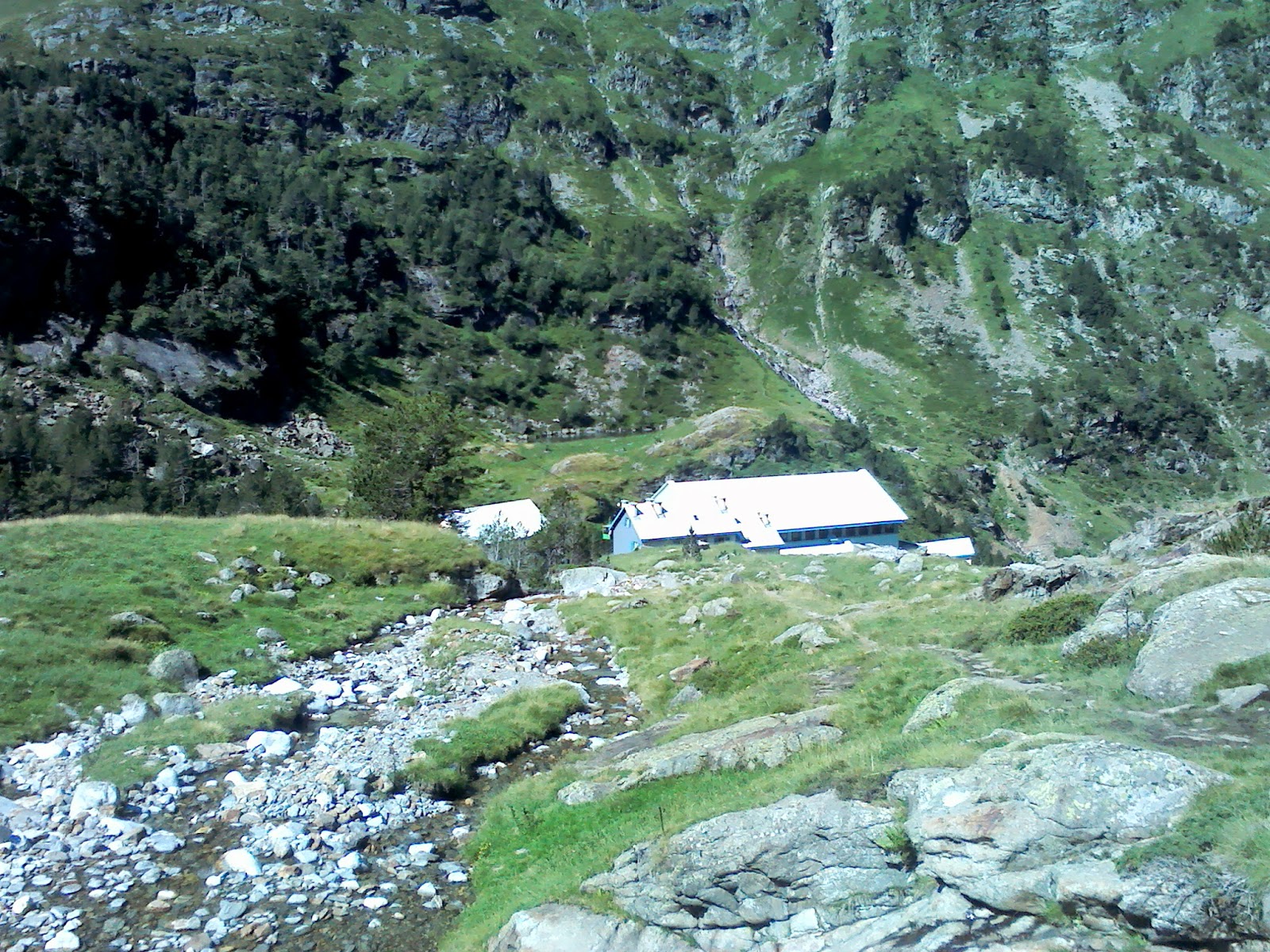

Looking down on the refuge from our hidden spot.

While an important benefit to the surrounding area, some would argue that the hydroelectric station and the larger refuges make for bigger eyesores - for those people I have a fantastic little hidden gem.

Views of the valley.
Just beyond the refuge the path swings to the left, further up the valley. If you want you can continue this path up to the beautiful Lac de Caillauas, however if you're pressed for time and want to enjoy this valley at its fullest, just up from the refuge there is a lovely spot on the river which is perfect for sitting, paddling and sunbathing. It also has great miniature views of its own: little rapids and waterfalls zip down the hillside right next to you, while sunshine dapples along the top of the subsequent pools. It is a fantastic little spot, and a great vantage point to admire the forests, meadows, rivers, cliffs and mountain tops of the rest of the valley. Take it all in, then retrace your steps - the gorge is not as frightening the second time around!


Our hidden spot on the river.

Sometimes walks surprise you. Hiking up to the Refuge de la Soula, I thought it might be a standard valley walk. Little did I know that not only would I be walking high up on the side of a gorge as part of that walk, but also that my "destination" was not in fact the refuge, but a little hidden spot on the river I had been following for the whole time. This is one of the best examples of what the Val Louron is all about, and well worth a visit. 

Tuesday, 19 August 2014

Col de Peyresourde

A short and sweet walk from the Val Louron's other quintessential mountain pass. 

DISTANCE: 4km
APPROX TIME: 1 hour
START: Col de Peyresourde
FINISH: Col de Peyresourde

In the last blog post, we explored the Col d'Azet on the western side of the Val Louron. This time, we shall explore the Col de Peyresourde, on the eastern side of the valley. Both mountain passes are significant for featuring in this year's Tour de France. This pass, however, is notably different to Azet, as it is much steeper on either side of the road which rides over the mountain pass, and there is a nifty little cafe in the centre. Looking over the other side of the Col arguably opens up even more views than the Col d'Azet, as we shall see.


Begin at the Col, and then walk back down the road towards the Val Louron. After less than a hundred metres, a wide track veers off to your right up the hillside. Follow this round - it starts relatively steep before easing slightly, then steepens again. You will then dogleg back on yourself up the hill, and then again, before coming to a fork in the road. Take the right-hand fork.

Following this fork, you will hit a fenced-off forest, with barriers erected to prevent avalanche. Walk parallel with the fence for a short section, and as you reach the brow of the hill (with the views to the east beginning to emerge) you should see a small footpath going up the hill to the left.

The view southwards.
The path is indistinct, but persevere up the hillside - it is relatively steep but not dangerous. At the top of the first ascent, you will come across a very curious object: perhaps a gas canister of a milk churn; the cylinder appears to have been there for almost a century - some of the graffiti on it includes the dates "1930, "1922" and even "1919".  Stop for awhile here, and then follow the path round the contour slightly to the highest point, and take in the view.

The long forgotten canister sits in front of the mountain scenery.
The immediate views to the north are quite Lake District-esque: rolling green hills with pointed ridges. To the west, you can see back to the col d'Azet, and beyond it the white behemoths of Pic de Neouvielle and its neighbours. To the north, you can now see the familiar sights at the head of the Val Louron disguise even bigger beasts; craggy monsters draped in snow. To the east, tremendous monoliths of the Spanish Pyrenees can be seen in the gaps between the relatively small peaks in the foreground.

The view towards the Col d'Azet and beyond.
Once you have taken in the views, you can continue to explore these Lakeland-like mountains around the Col de Peyresourde. Otherwise, retrace our steps.

Beginning the descent.
The other quintessential mountain pass of the Val Louron, the Col de Peyresourde offers great views both near and far. Recommended.

Friday, 15 August 2014

Tuc de Labatiadere

A great viewpoint accompanied by an easy walk from an iconic Pyrenean pass.

DISTANCE: 5km
APPROX TIME: 1hr 3
START: Col d'Azet
FINISH: Col de

One of the best things about the Louron valley is the ease with which you can gain height relatively quickly - if you have a car, getting high enough to see expansive views is easy. Thus when you arrive at the Col d'Azet - a short drive up the west side of the valley from Loudenvielle - you are greeted with some fantastic mountain views from the outset. This walk provides a slightly enhanced version of the landscape that surrounds you at that mountain pass, after what is a gentle and safe ascent.


Park at the Col, and then cross the road, heading north eastwards onto the opposite track (marked by the "no entry for vehicles sign" - incidentally this sign will be repeatedly ignored as multiple cars and vans carrying parapenters, who take off from the Tuc de Labatiadere into the valley below, pass you as you walk up the track). This track stays fairly level as you gradually ascend in between the spurs and hillocks to your right and left. Mountain cattle graze on these grassy areas, but should not bother you if you stick to the track. 

Looking back towards the Col (left of photo), with great near views southwards.
You may see paths veering off to the right or left, some of which may even be signposted. However, these are mainly used by the parapenters as they jump off the eastern slopes, so sticking to the track is the best route to take. As you walk, you should be able to see the Lac de Genos-Loudenvielle down to your right, surrounded by a great display of all the peaks the Val Louron has to offer. To your left, snowy and jagged peaks to the west should begin to emerge. Look up, and you may even be able to see an eagle or a hawk.

At the end of the track, you come to a ramshackle concrete building - look up the hill behind the building and you will see a path heading up towards a little weather station on the top of the hill. Follow the path up to the station, and you reach one of this walk's major viewpoints.  All around you, mountains: the Louron valley's peaks sit to the east, with even bigger mountains sitting in the distance, over the Col de Peyresourde. Over in the west, ice-capped peaks glisten in the sunshine, including the formidable Pic de Neouvielle. Perhaps the best views, however, are in the near distance: if you look back to the Col d'Azet, behind it and around to the right from it you can see a series of rocky monoliths, each with fantastic intricacies, the 2800 metre Pic de Lustou among them. For a near-distance view (many of the mountains block off what lies behind) it is one which takes a while to really sink in.

Up at the top of Tuc de Labatiadere, accompanied by some horses!
Look behind you, away from the views, and you will see you are on a high moorland plateau, with beautiful wildflowers and gorse bushes sprouting among the grass. Take the path down to the right, towards the rocky outcrop to see a better view of the Louron valley. Alternatively, take the left fork towards the other hillock, the highest point on this plateau, for the most comprehensive view the Col d'Azet has to offer. Once you have explored the
plateau, reverse your steps back to the Col.

Views from the top
A fantastic viewpoint with very little effort required. With bonuses of being able to see eagles and hawks, as well as parapenters launching off the ridge, this is highly recommended.

Tuesday, 12 August 2014

Les Chapelles D'Artiguelongue

A beautiful valley stroll to a historically important site, this walk offers something for everyone.


DISTANCE: 5 miles
APPROX TIME: 2 hours
START: Loudenvielle
FINISH: Loudenvielle

One of the things you realise when you come to an area like Loudenvielle is the sense of history. Many of the buildings which pepper the valley sides have been there for hundreds of years, and several have been historically important for military, political or religious reasons. This walk is a relatively gentle valley walk to one such important site, perfect for an easy day or when the weather is not at its best.

Sunday, 10 August 2014

Introduction to Loudenvielle

This year's undiscovered walks sees your intrepid explorer head not to the Alps, but the Pyrenees. The Pyrenees National park is as beautiful and well visited as its Ecrins and Vanoise counterparts in the Alps, and is thus a great destination for any budding explorer. As this blog's title suggests, however, I am not always interested in the great heights of these national park areas, as awe-inspiring as they are. No - often I am more concerned in highlighting some of the areas and walks which many of the other guides miss. That is why, this year, I have come to the Val Louron (the Louron valley) and the village of Loudenvielle.

Search This Blog